Fantasy World Cartography Portal
Unrolling Ancient Manuscripts...
Chronicles of Other Worlds
Active Atlas
1024 x 1024 | Sepia Parchment Edition
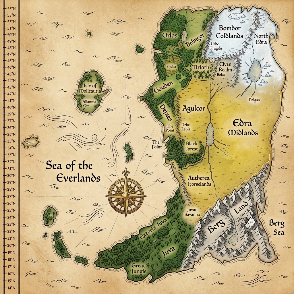
The primary fantasy continent of your realm. Equipped with real-time latitude/longitude grids, golden SVG region outlines, and persistent CRUD chronicle editing.
Template | Ready for Integration
An eastern kingdom characterized by floating islands and shattered archways. You can easily drag and drop your next LOTR-style draft image here to build another interactive map!
Template | Ready for Integration
A deep-frost arctic setting featuring severe volcanic fissures and legendary leviathan paths. Prepared to be loaded as a secondary CRS layer on your site.
Dynamic Registry of Mapped Landmarks
Creator of The Everlands
Master Cartographer & World-Builder
Evan S. Beach is an accomplished creative world-builder and cartographer, known for designing detailed geographical settings that bring fictional realms to life. Combining hand-drawn analog precision with advanced digital GIS-style layering, his maps capture the scale, atmosphere, and history of original fantasy universes.
The Everlands represents his premier world-building project—a sprawling, continent-level study in geography, microclimates, and regional boundaries. From the transparent crystalline spires of Urbe Fragilis to the volcanic obsidian ranges of Berg, every peninsula and mountain fold has been carefully plotted to forge a deep, coherent universe.
Through this interactive cartography portal, visitors can explore his parchment drafts, contribute new custom locations, and navigate the expanding scrolls of history and lore that define the realms of the Everlands.
Looking to bring your own tabletop RPG campaign, novel, or creative setting to life with custom LOTR-style cartography?
Contact Studio